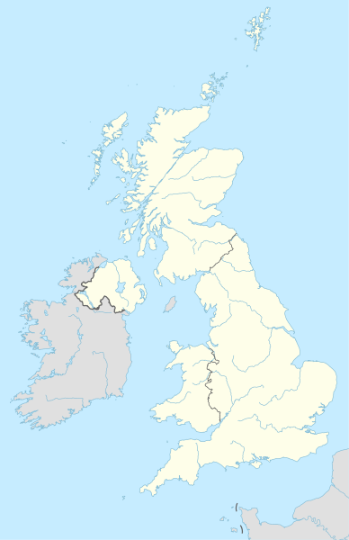
Ӳкерчĕк:United Kingdom adm location map.svg
Оригиналлӑ файл(SVG файлӗ, йӗркеллӗ виҫе 886 × 1369 пкс, файл калӑпӑшӗ: 703 Кб)

Ку файлпа, на Викискладе илнӗскерпе, ытти проектсенче усӑ курма пултараҫҫӗ. Унӑн страницӑри ӑнлантарӑвӗпе аяларах паллаштарнӑ.

Кĕскен ăнлантарни

Ӑнлантарни
Deutsch: Positionskarte des Vereinigten Königreichs
English: Location map of the United Kingdom

Equirectangular projection, vertical stretching 170 %
Border coordinates

61.0
-11.0←↕→2.2
49.0
 Для справки This map is part of a series of location maps with unified standards: SVG as file format, standardised colours and name scheme. The boundaries on these maps always show the de facto situation and do not imply any endorsement or acceptance. In case of changes of the shown area the file is updated. The old version will be uploaded as a new file and thus is still available.
Дата
Ҫӑлкуҫ

Собственная работа, используя:

  • United States National Imagery and Mapping Agency data

a. this product was developed using materials from the United States National Imagery and Mapping Agency and are reproduced with permission. b. this product has neither been endorsed nor authorized by the United States National Imagery and Mapping Agency or the United States Department of Defense.

  • World Data Base II data (public domain)
Автор NordNordWest
Kartenwerkstatt
Эта карта была улучшена в немецкой Kartenwerkstatt. Вы можете также предложить другие карты для улучшения.

Лицензилени

Usage of this file with:

explanatory notes: Legally binding is only the full legalcode. For a free usage I recommend to respect the following licence conditions:
1. Provide my name as given above: NordNordWest,
2. a copy of, or the URI for, the applicable license: https://creativecommons.org/licenses/by-sa/3.0/de/legalcode,
3. the title of the work,
4. in the case of an adaptation, a credit identifying the use of the work in the adaptation.
This license and the rights granted hereunder will terminate automatically upon any breach by you of the terms of this license. Any of the above conditions can be waived if you get permission from the copyright holder. If you have questions or wish differing conditions, please contact me through nnwest@t-online.de or my discussion page

w:cv:Creative Commons
атрибуци ҫав условисемпех сарма юрать
Этот файл доступен по лицензии Creative Commons Attribution-Share Alike 3.0 Германия.
Атрибуци: Karte: NordNordWest, Lizenz: Creative Commons by-sa-3.0 de
Эсир ирӗклӗн:
  • ку ӗҫе ыттисене тивӗҫтерме – ку ӗҫе копилеме, сарма тата ыттисене пама
  • унашкаллисене хатӗрлеме – ку ӗҫе улӑштарма
Ҫак условисене пӑхӑнсан:
  • атрибуци – Сирӗн кам автор пулнине кӑтартмалла, лицензи ҫине каҫӑ памалла та автор мӗнле те пулин улшӑнусем кӗртнипе кӗртменнине палӑртмалла. Ҫакна кирек мӗнле юрӑхлӑ меслетпе те тума пулать, анчах лицензиат сире пулӑшнине е сире асӑннӑ хайлавпа усӑ курма ирӗк панине кӑтартмасӑр.
  • ҫав условисемпех сарма юрать – Енчен те эсир асӑннӑ хайлава тӗпе хурса ҫӗннине йӗркелетӗр, улӑштаратӑр, е урӑх хайлав тӑватӑр пулсан, сирӗн тӗпри хайлавӑн лицензипе е унпа пӗрешкеллипе усӑ курма тивет.

Краткие подписи

Добавьте однострочное описание того, что собой представляет этот файл
Местоположение на карте Соединенного Королевства

Элементы, изображённые на этом файле

изображённый объект вырӑс

Bredon акӑлчан

MIME-тип вырӑс

image/svg+xml

Файл историйĕ

Вӑхӑт ҫине пуссан, ун чухнехи версине пӑхма пулать.

Дата/ВăхăтМиниатюраКалӑпӑшХутшăнаканАсăрхав
хальхи20:13, 28 Ака уйӑхӗн 201520:13, 28 Ака уйӑхӗн 2015 вӑхӑтри версийĕн миниатюри886 × 1369 (703 Кб)NordNordWest== {{int:filedesc}} == {{Information |Description= {{de|1=Positionskarte des Vereinigten Königreichs}} {{en|1=Location map of the United Kingdom}} {{Location map series N |stretching=170 |top=61.0 |bottom=49.0 |left=-11.0 |right=2.2 }} |Source={{Own u...

Файлпа глобаллӑ усӑ курасси

Метаданнăйсем: